Etchinghill to Dover
Etchinghill to Dover | |
Introduction
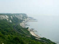
Reaching the coast and the beautiful White Cliffs of Dover is a fitting end to the North Downs Way. From Etchinghill you're soon towering over the busy Channel Tunnel Terminal and the town of Folkestone below. Soon the busy railway line and road head underground as the path heads towards the coast. Once at the coast The North Downs Way follows the cliff top along the white cliffs all the way to the busy port of Dover, the end of the North Downs Way and a satisfying way to end. From here just a few miles of sea split Britain from mainland Europe, regularly crossed by ferries.
Getting to the Start
Etchinghill is just a few miles from the M20 motorway. From the west, exit at junction 11 and join the A20 towards Folkestone. Look out for a left turn as the road curves round to the right, into Sandling Road. Continue on this road as it narrows. At the junction at the end of the road turn right into Canterbury Road which goes through the edge of Newbarn then into Etchinghill. If arriving from the East, exit the M20 at junction 12 onto the A20 west, towards Ashford. At the first roundabout turn right and continue on this road into Etchinghill. There isn't a public car park in Etchinghill so you'll need to park on-street. This is possible on the main road through the village or on one of the residential streets. The pub may also be willing to let you use their car park, but do ask first.
If you're travelling by public transport, there is a bus service to Etchinghill. Stagecoach East Kent bus number 17 runs approximately hourly Monday - Saturday and once every 2 hours on Sundays from Folkestone and Canterbury to Etchinghill, taking around 20 minutes to get from Folkestone To Etchinghill (also passing the station in Folkestone) and around 45 minutes to get from Canterbury to Etchinghill. If you're travelling from further afield, both Folkestone and Canterbury have stations, although Folkestone is a little more convenient, as the bus passes it.
The Walk
Etchinghill village is a mix of old and new. Whilst the pub, and properties nearby are clearly quite old, there is also a small modern housing estate to the east of the town. From the village centre head east down Canterbury Road, and just as the road starts to turn to the right, continue straight on down the lane that heads downhill to Coombe Farm. Shortly after taking this lane, turn off left when signed towards the tunnel. Go under the tunnel under the disused railway, leaving the Elham Valley Way behind.
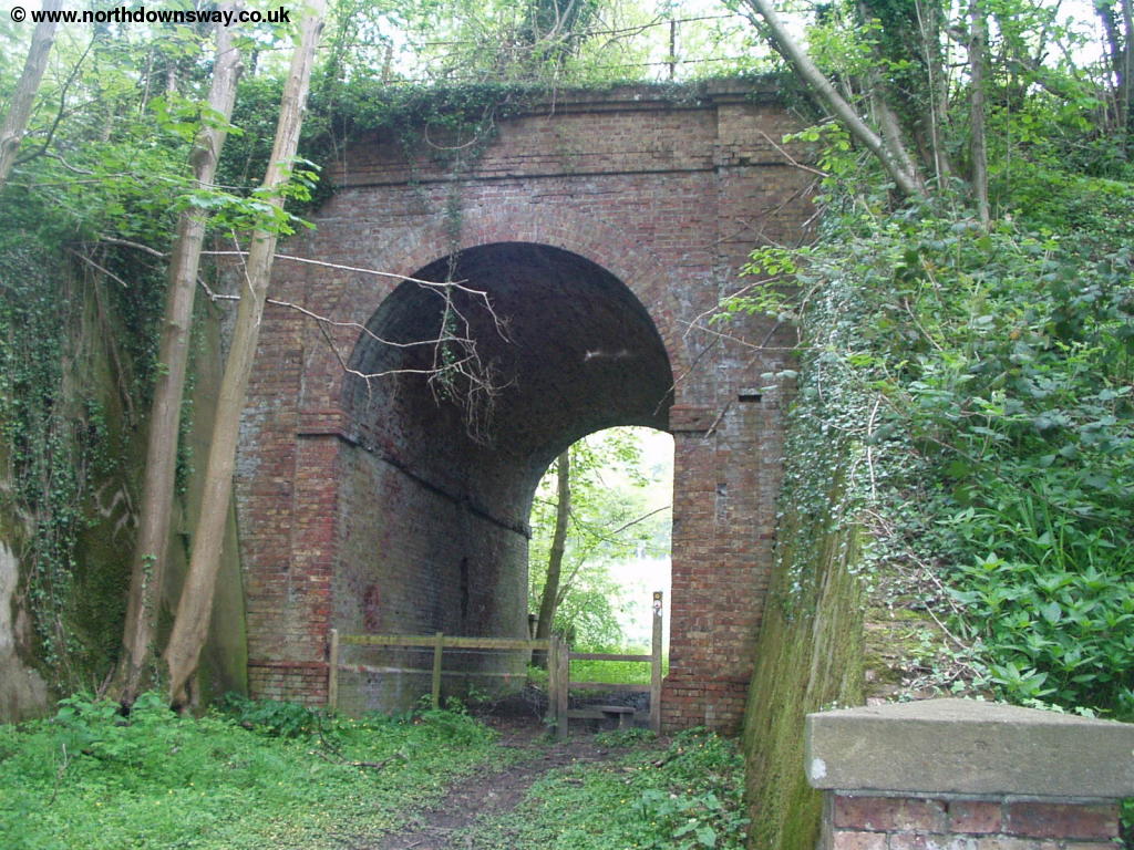 |
| The path goes under the disused railway line |
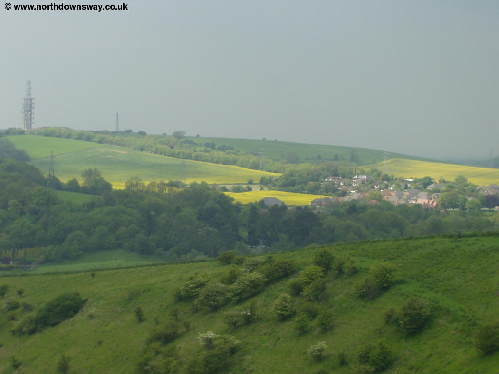
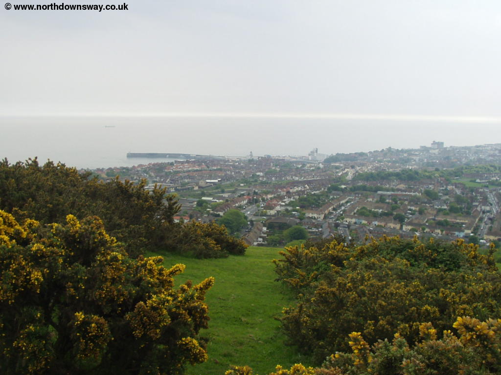
Once under the old railway line the path climbs steeply up a grassy valley, although at the top you are rewarded with excellent views of Etchinghill in the distance and the outskirts of Folkestone below you and the sea beyond.
 |
 |
| View from the top of the hill | The outskirts of Folkestone below |
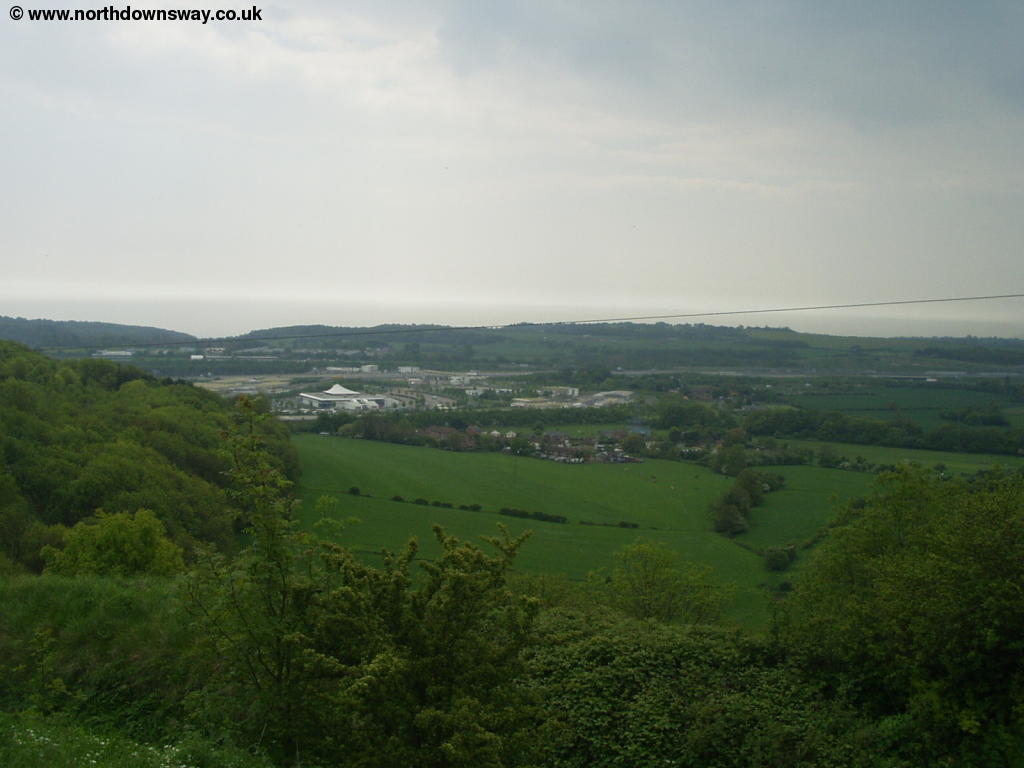
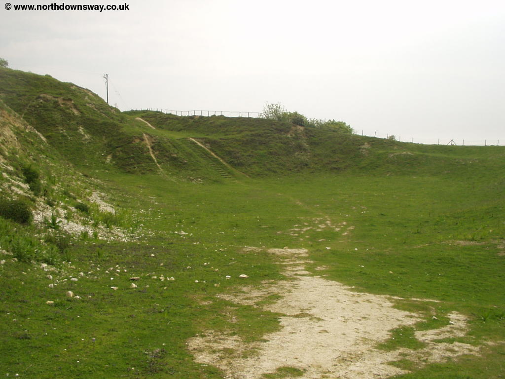
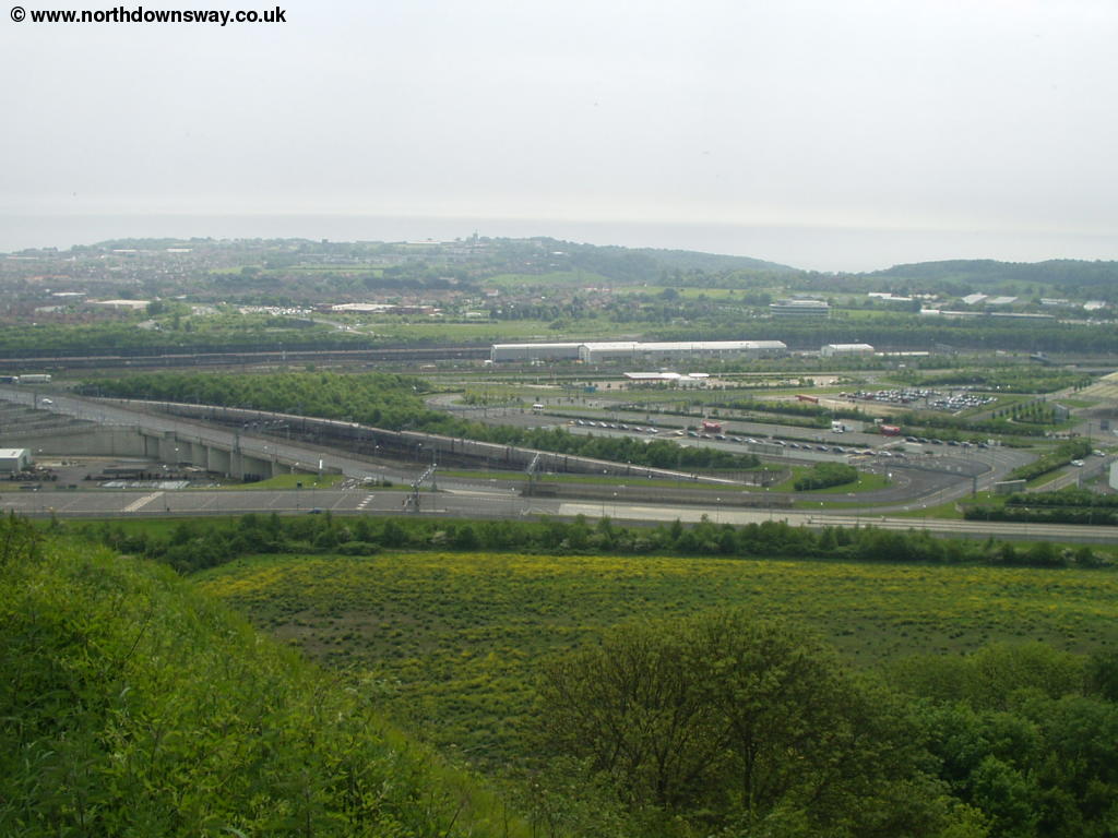
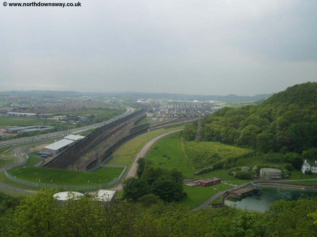
Follow the signs around the top of the hills before you descend down a farm lane again. The guide to the path mentions that this lane always seems to be wet and it certainly seems correct as even after a couple of weeks without rain the path is very damp and boggy. At the end of this path you emerge onto a lane, which you cross and then join the path next to the road, turning right soon after entering the field, heading back towards the coast. Here below you begin to see the massive Channel Tunnel Terminal below you, which causes quite a noise. Here you have to contend with the noise from the almost constant Eurotunnel trains, freight trains and Eurostar trains, as well as the busy traffic on the nearby M20. At the bottom of the field you pass through the remains of a quarry.
 |
 |
| The quarry | The Channel Tunnel Terminal below |
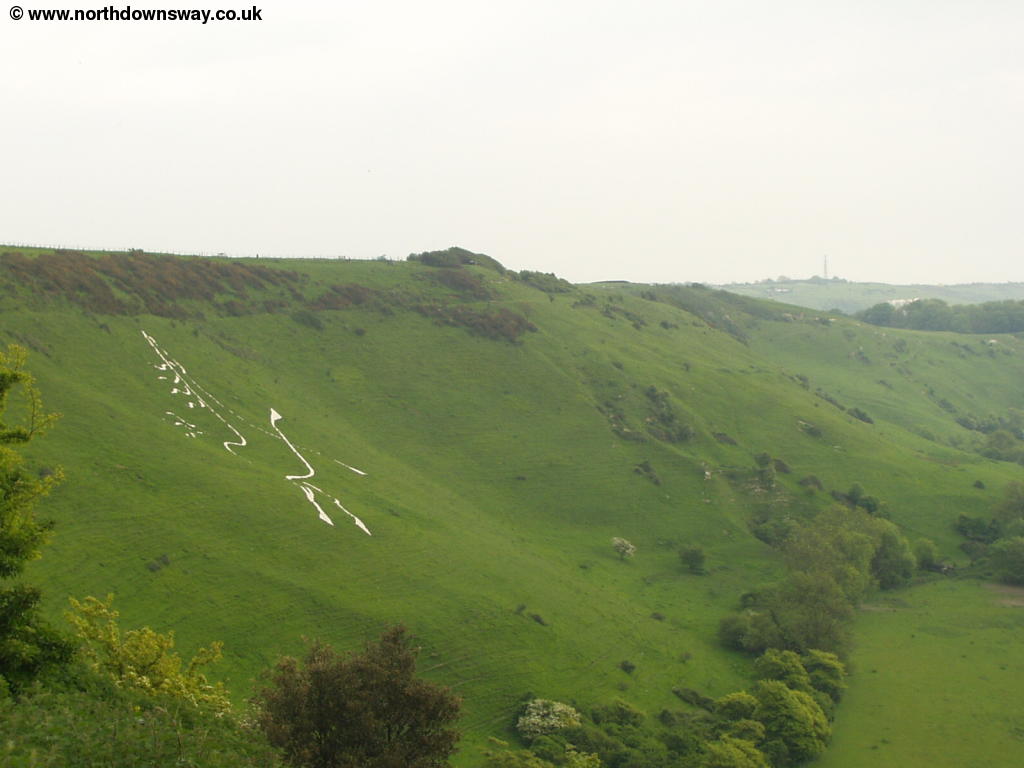
Continue along the edge of the cliffs above the rail terminal, passing the odd concrete pill-box. Soon you see the Folkestone Millennium White Horse, designed by Charles Newington. The sign describing the horse recommends you view it from the Tesco car park - hardly the most attractive of settings! The path continues at the top of the cliff, just a short distance back from the quiet lane, at the edge of the cliffs. There are a few paths going off to the east down the hill, but the North Downs Way is well signed ahead.
 |
 |
| The Folkestone Millenium White Horse | View from the North Downs Way near Cheriton Hill |
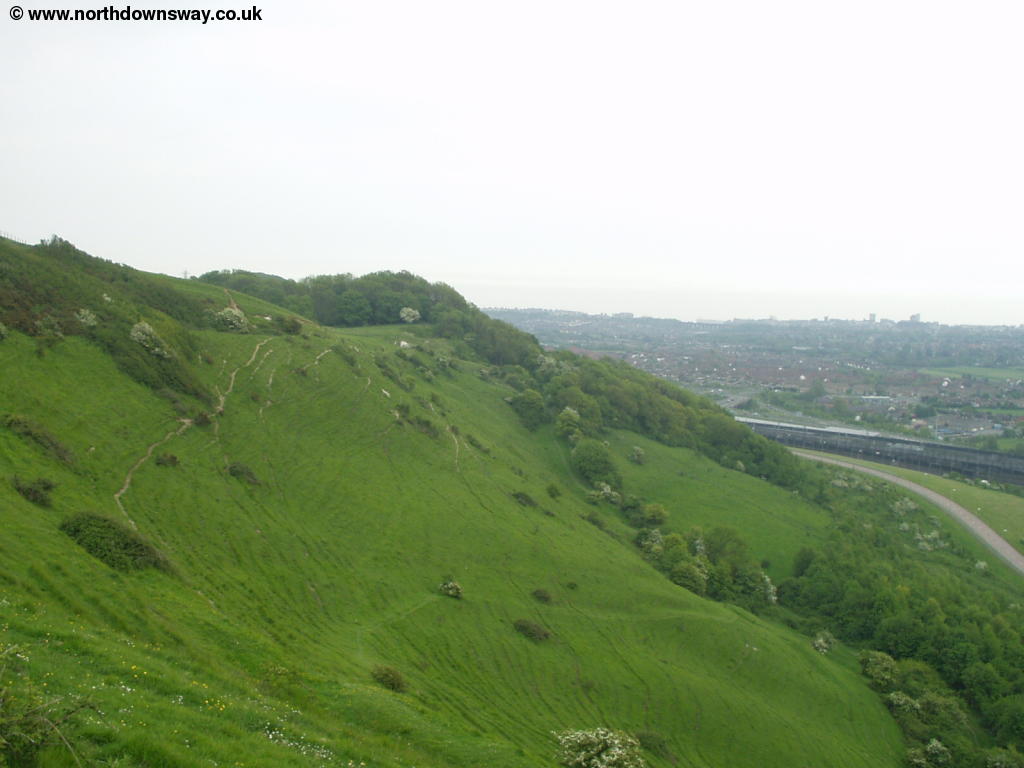
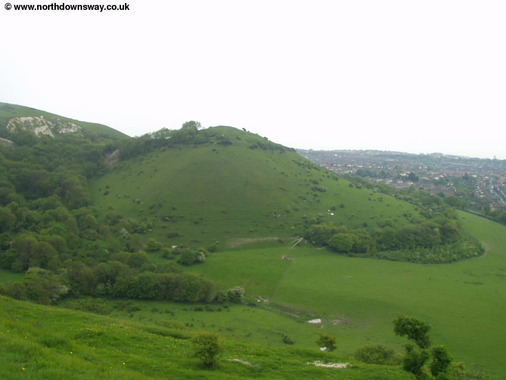
Soon you go round woods round the edge of a reservoir. Here you briefly join the road (Castle Hill) then enter the old works at Caesar's Camp. Below you is a steep value with the round Sugarloaf Hill at the other end. Looking back you can now see the reservoir that was obscured by the trees earlier and the railway lines converging before plunging underground into the Channel Tunnel to France. Ahead, the busy A20 also heads into a tunnel under the cliffs, but this time just to the other side of the downs, rather than to France!
 |
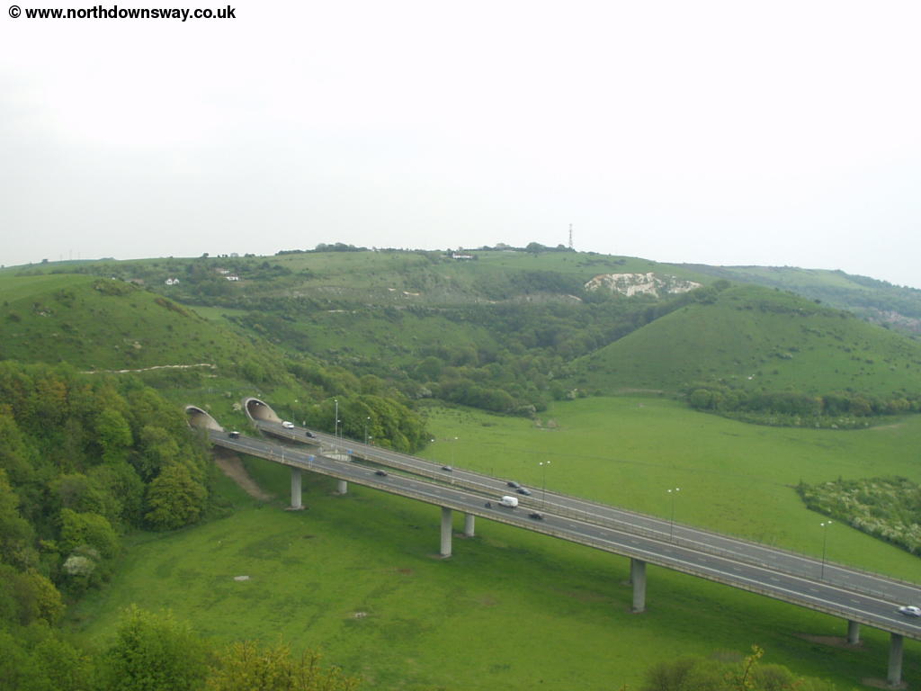 |
| The reservoir and the railway lines entering the Channel Tunnel | The A20 enters a tunnel |
 |
|
| Sugarloaf Hill |
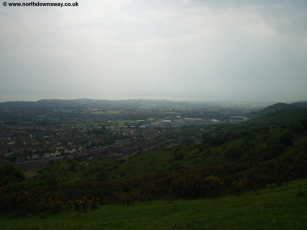
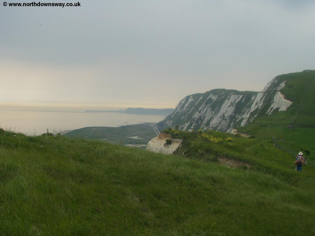
As you go over the road tunnel you turn slightly to the left towards the residential road. At the end of this road (Crete Road West) you have to cross the busy A260 into Crete Road East, where you walk past the houses for a short distance before rejoining the path. At the road junction, you continue straight on at the top of the cliff, now on the edge of Dover Hill. The top of the hill is marked by another old pill-box, but the views from here are superb. You can see right back over Folkestone and the Channel Tunnel Terminal and to the downs beyond, as well as views to the channel and even (on a clear day) France beyond. The town of Folkestone was made busy by it's harbour, but now the harbour lies empty and apparently disused below, the last passenger ferries and hovercraft's sailing from the port several years ago (a contrast to the busy port of Dover just around the coast).
 |
 |
| Folkestone from Dover Hill | Folkestone from Dover Hill |
From Dover Hill continue on the path as it descends slightly to the road. Cross the surprisingly busy road and follow the path to the right of the pub, bringing you out to the beautiful white cliffs, that make a fantastic finale to the North Downs Way. From here the North Downs Way now follows the coast for the next few miles, with stunning views of the beautiful cliffs and out to sea, as well as the town of Dover ahead.
 |
| The beautiful White Cliffs ahead |
Continue east on the cliff-top path, where you see the white cliffs ahead, the harbour of Folkestone behind you and the nature reserve known as The Warren and the railway line between Folkestone and Dover below. Although the path looks fairly rural here, it is somewhat squashed in between the cliff edge and the gardens of houses and caravans.
 |
 |
| The White Cliffs ahead and The Warren below | The view back to Folkestone |
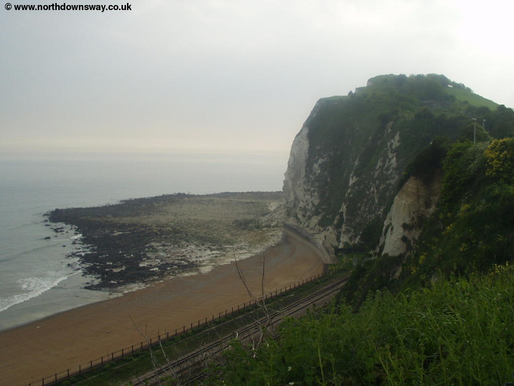
Soon you pass open grass on the left and the war memorial, followed by the houses of Capel-le-Ferne right next to the path on the left. This part of the path is, as you'd expect, popular with many people enjoying the glorious views from the cliff top path. You briefly have to leave the coast to go round a large white house that is very close to the edge. Below you the railway now enters a tunnel under one of the steeper parts of the cliff. Along this section of the coast there are the remains of all sorts of old (mostly military) buildings, a reminder of how well defended this part of the coast used to be, including a large concrete dome on top of the cliffs.
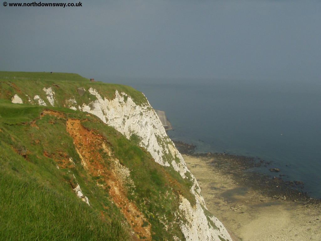 |
 |
| The White Cliffs and beaches below | Old buildings on the cliff top |
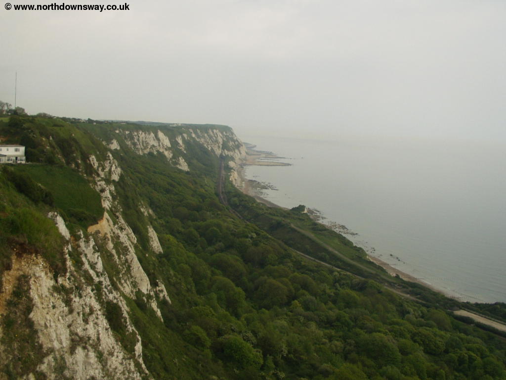
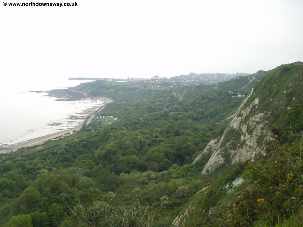
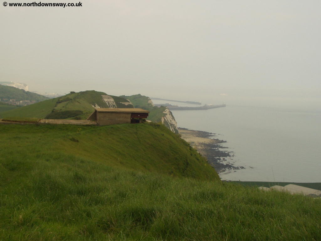
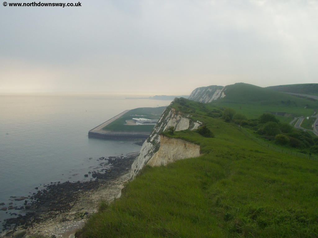
Below you you'll soon see a large concrete platform at the bottom of the cliffs as the railway emerges from the tunnel. This is the area now known as Samphire Hoe Country Park and is made from material removed during the excavation of the channel tunnel. The area is now a nature reserve, though the far end of the land seems to be occupied by some sort of industrial building with many fans whirring round in the roof.
 |
 |
| The white cliffs and Samphire Hoe below | Looking ahead to Dover Harbour |
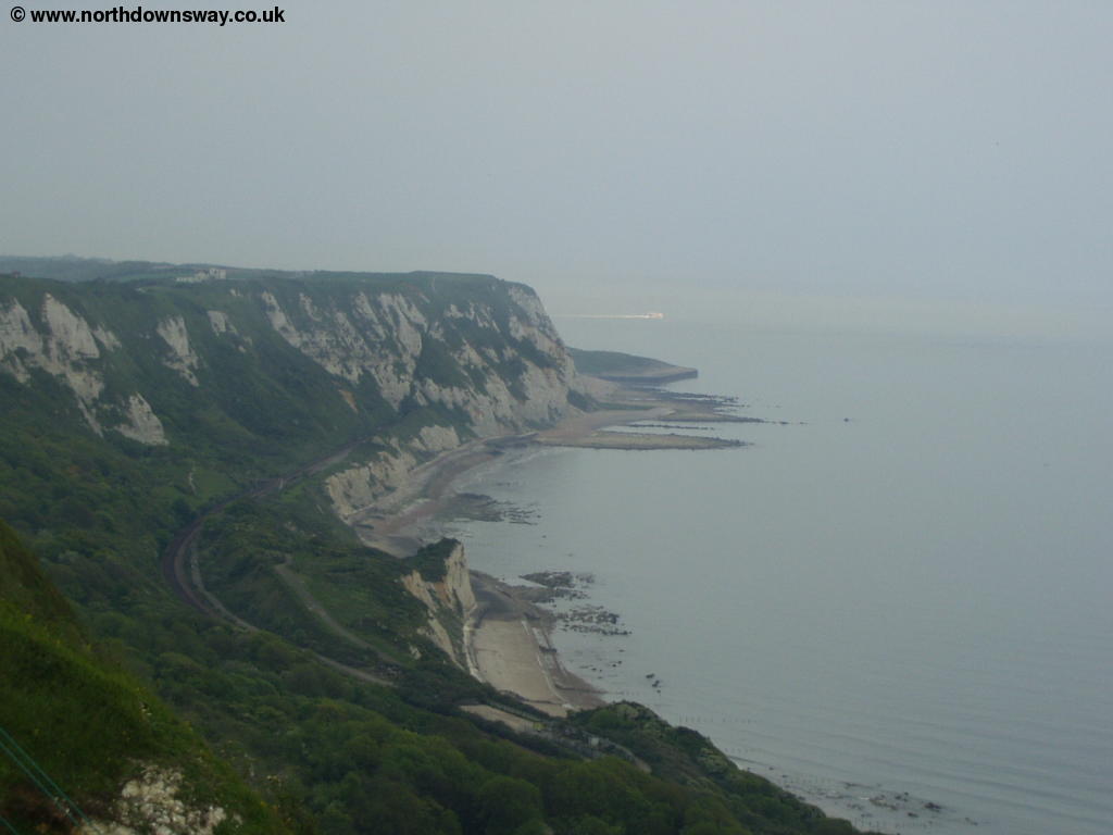
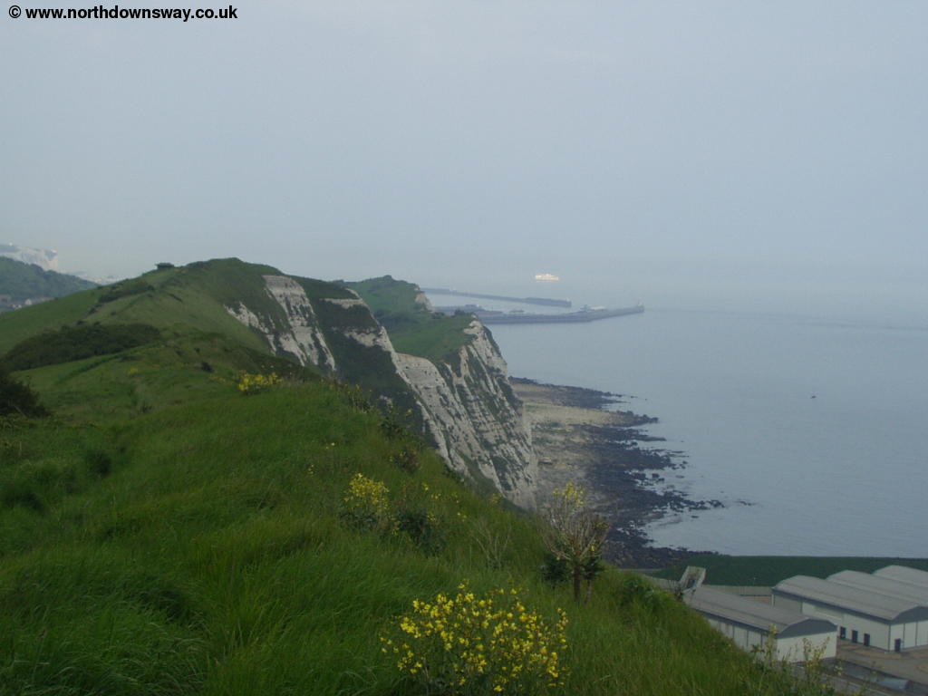
The busy A20 gets a little closer to the path as you pass Samphire Hoe however it is less intrusive than you might imagine given it's proximity to the path. Towards the end of the reclaimed land of Samphire Hoe the cliff path drops rapidly only to climb again up the next cliff (Shakespeare Cliff) where you can see through to Dover ahead and where the railway line heads back into a tunnel once more. This is the last major climb on the North Downs Way.
 |
 |
| Looking back to Samphire Hoe | Looking back to Samphire Hoe and Folkestone from Shakespeare Cliff |
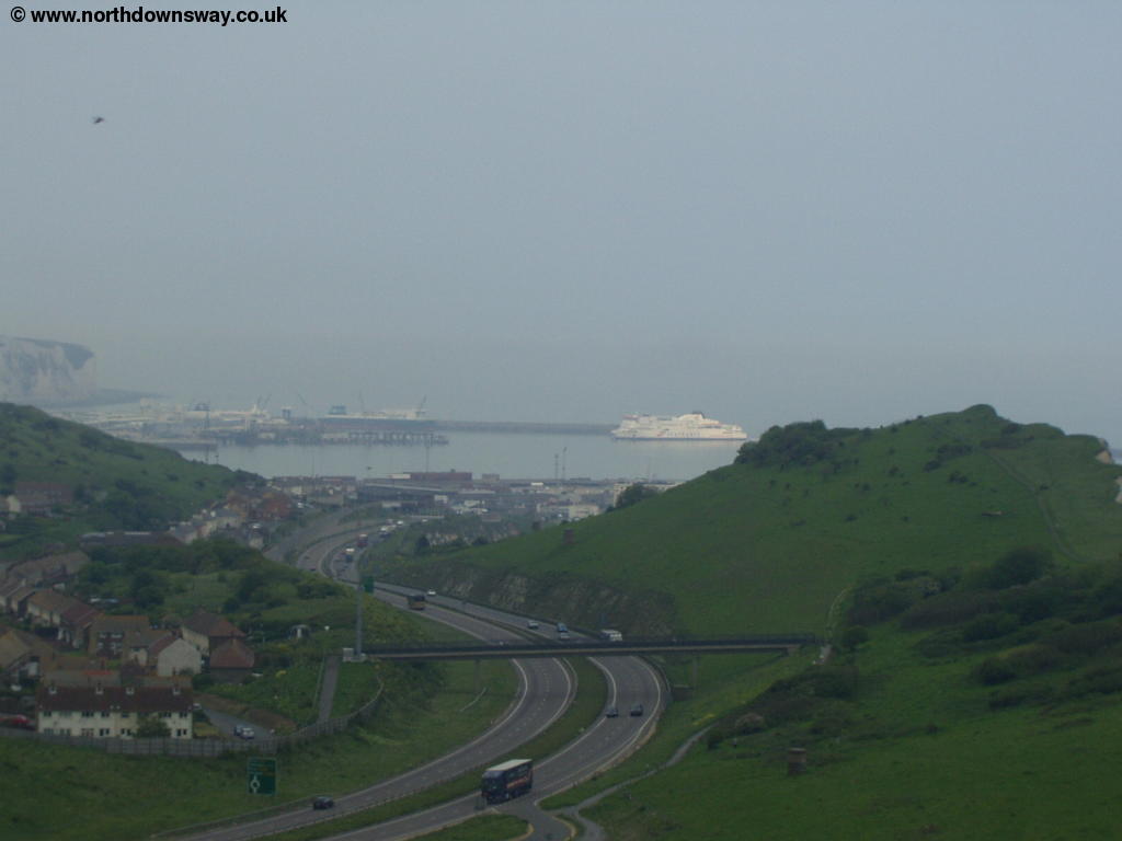
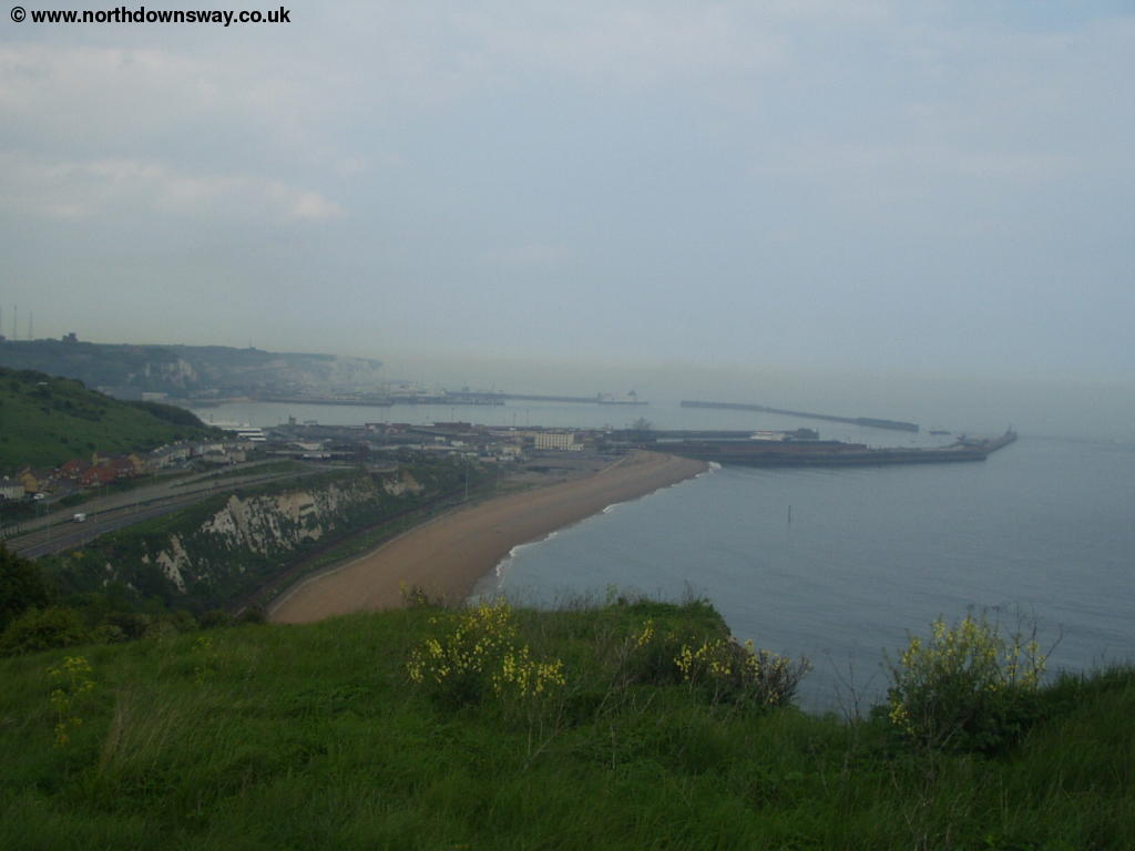
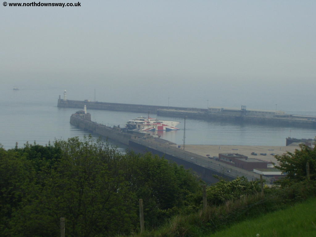
As you climb the cliff you'll be passing over the Channel Tunnel as it heads towards France. Ahead you can see the outskirts of Dover and the busy harbour. The many ferries and other boats can be seen leaving the harbour ahead, usually to cross the English Channel to France, just 21 miles away at the narrowest point, making this one of the busiest seaways in the world. At the top of the cliff you have stunning views of the shingle beach below leading towards the harbour, the large harbour and mariner, the castle and the white cliffs continuing beyond Dover to South Foreland.
 |
 |
| The beach, harbour and town below | The beach and harbour |
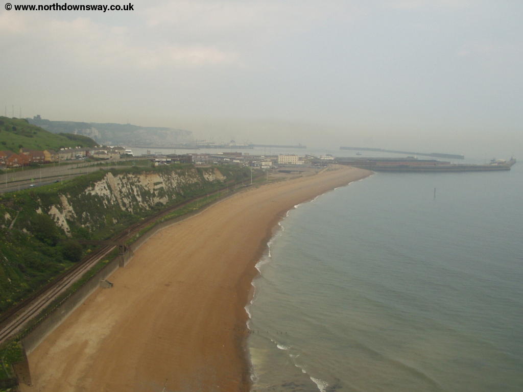
All to soon you find the path descending Shakespeare Cliff towards the beach below and the town to the left. There are still excellent views ahead and, as you descend the cliff, of the cliff behind you. Soon you come to a subway on the left, under the road, where the path now leaves the coast.
 |
| Looking back to Shakespeare Cliff |
You emerge from the underpass into King Lear's Way the turn right into Kings Ropewalk where you find some steps at the end of the road onto a grassy hill. This is the area known as Western Heights and now houses a Young Offenders Institution as well as the large old fort which are now open for you to explore.
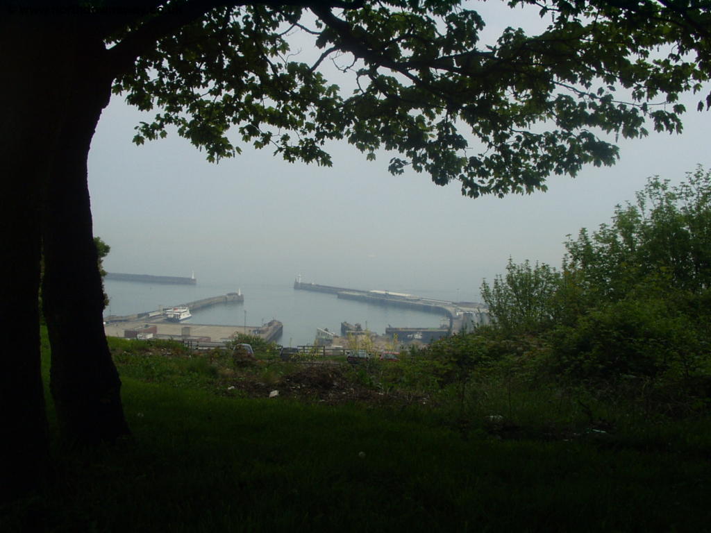 |
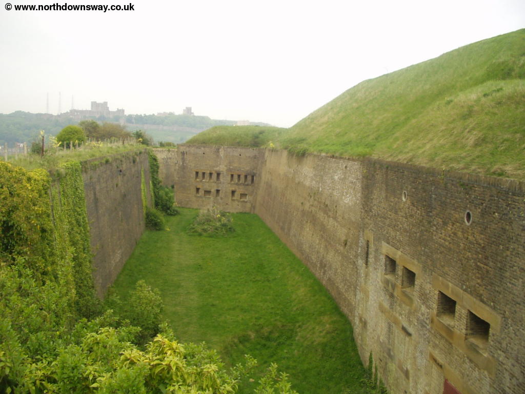 |
| The harbour from Western Heights | Western Heights, with the castle beyond |
The path by Western Heights is however a little difficult to follow here, so follow the signs carefully, as you initially follow the road before going round the edge of the complex where you get fine views over the town below you.
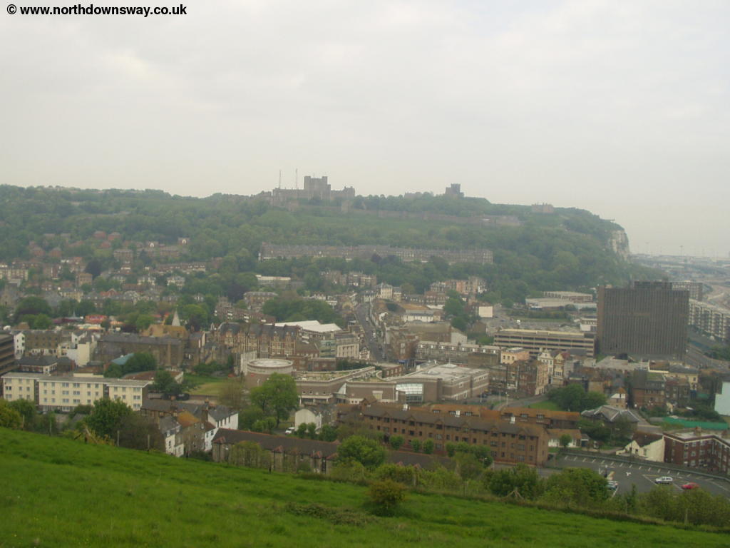 |
 |
| The town from Western Heights | The harbour, with the rather patriotic Hover Speed Catamaran |
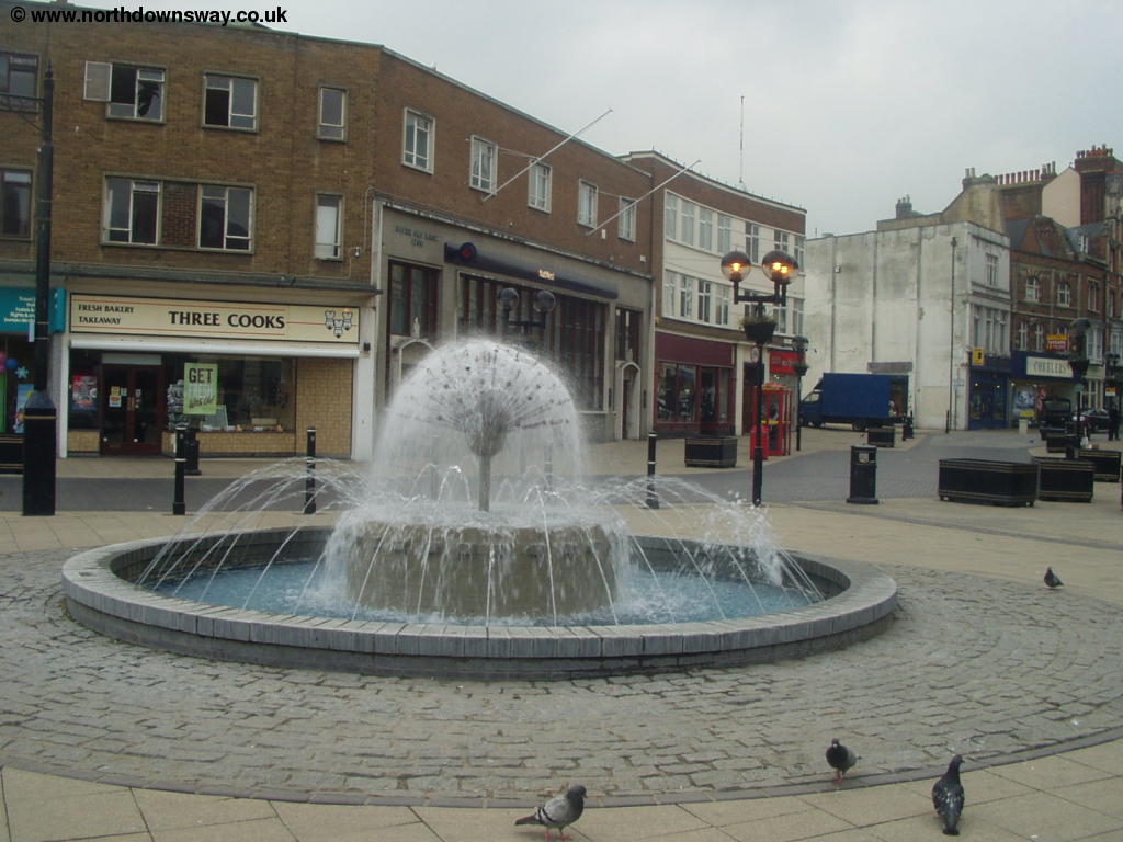
Soon the path descends and you emerge into Adrian Street which you follow until it emerges onto York Road. Cross the road at the traffic lights and go down Queen Street where you emerge onto the market square of the town. The town centre is not the most attractive and sadly has a rather run-down feel, as it seems to consist of a lot of takeaways and some of the buildings are boarded up.
 |
| Dover Town centre |
I found the town centre something of a disappointment given the attractive setting of the town. Nevertheless the sea-front area is reasonably pleasant, and the massive castle that dominates the town is excellent and well worth a visit if you have the time and energy! The castle is built into the cliffs and even has windows part way down the cliff face, looking right out to sea. Arriving at the coast is a rewarding end to this lovely path though it's a shame there doesn't seem to be anything to commemorate the end of the path in the town centre. The only way to proceed south eastwards now is on one of the many ferries to Calais. However there are plenty of ways to continue walking from Dover. The North Downs Way continues north from Dover to Canterbury. Sticking to the coast, the Saxon Shore Way is a satisfying 163 mile path round the coast from Hastings to Gravesend, continuing north east from Dover towards Deal.
Getting Back
Dover Priory station, slightly to the north west of the town centre, has frequent trains to London (Victoria, London Bridge, London Charing Cross and London Cannon Street), as well as local services to Folkestone, Ashford, Canterbury, Ramsgate and Faversham, all operated by South Eastern Trains. If you're returning to Etchinghill the journey is a little harder since there isn't a station in Etchinghill, however there is an hourly bus service (Monday - Saturday) from Folkestone and Canterbury, operated by Stagecoach East Kent. The most scenic way is to take the train to Folkestone Central, this is the line that runs along the coast below the North Downs Way to Folkestone. The bus pases close to Folkestone Central station on it's way to Etchinghill, however connections with the trains are fairly poor. The other way, take a train from Dover to Canterbury East Station then walk to the bus station for the bus to Etchinghill. Neither option is particularly quick, as the journey will typically take at least an hour.
If this journey proves too slow or the bus is not running (for example on a Sunday) or is not running frequently (during the evening) another possibility is to get a train to Sandling, the closest station to Etchinghill and on the direct line from Dover, then a taxi from there to Etchinghill, a couple of miles away.
Links
The following web sites provide information on the area.
Every effort is made to ensure the accuracy of information on this site, but liability will not be assumed in the event of any inaccuracies. Use of the information on this site is at your own risk. If you find any errors, please use the link below. The text and photographs on this web site are all Copyright © and may not be reproduced without prior permission.